Until the summer of 2009 all MAX light rail traffic in downtown
Portland followed the original routing to and from Steel Bridge.
This took trains along NW and SW 1st
Ave., and across city center westbound on SW Morrison St., and
eastbound on SW Yamhill St.
That changed with the opening of rail along
Portland Mall. The newer service crosses Morrison and Yamhill at right angles
along SW 5th Ave. southbound, and SW 6th Ave., northbound, near Pioneer
Courthouse Square and the heart of the shopping district. Its rails
carry two main MAX routes: the relocated center city portion of the Yellow
Line to and from Expo Center; and the Green Line to and from Clackamas Town
Center, new to the system that year.
After leaving Steel Bridge heading southbound, Mall rails curve briefly away toward the
northwest and Union Station, and
then curve again, sharply, to travel along NW and SW 5th Ave. for a run that
encompasses six stations out to the campus of Portland State University.
Trains in the opposite direction travel one block further west through
downtown, and also have six stations in downtown.
The Mall is a bit over one
and one-half miles long.
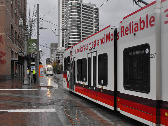
The terminals, southbound and northbound, are within the Free Rail Zone. This image shows the last station
southbound, appearing on the block ahead, identified on maps as PSU Urban Center/SW 5th & Mill. Trains then go out of
service, as the nearer train has done, to continue further before looping over to SW 6th
and then some blocks further, beginning the return journey.
The rails crossing MAX toward the bottom of the scene belong to the Portland
Streetcar, on its one-way routing toward downtown and Northwest Portland. |