|
The agency that operates the light rail network, as well
as the area's
extensive bus system, and also a commuter rail line on the Westside, is formally the Tri-County Metropolitan Transportation
District of Oregon. It is customarily known as TriMet. Light rail consists of
four lines, collectively called Portland MAX. The
second part of that title
is an approximate acronym for "Metropolitan Area Express." Its selection
as the nickname for light rail
was the result of public voting done while the initial part of the system
was being built in the 1980s.
An area that encompasses downtown and
a strip through the Rose Quarter and Lloyd District east of the Willamette
River, is free at all times for MAX (and Portland Streetcar) riders whose
entire trip is within the boundaries.
That "Free Rail Zone" is treated in this first section of these pages.
And the material is further divided into four segments, which
cover, sequentially, the original route in downtown; Steel Bridge; the free territory east of the Willamette River;
and then back to center city, touring the much newer Portland Mall route.
Further sections leave the free zone, and cover, in order, Eastside MAX out to
Gresham; the Westside line to Hillsboro; the Red Line to the Airport (beyond
where
it leaves the Blue Line); the Yellow Line to Expo Center; and the Green Line
to Clackamas Town Center, also after it leaves the Blue.
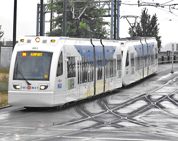
The view on this page shows a Red Line train just off Steel Bridge, east
of the Willamette River.
This model is the newest of the four models acquired by MAX over the years.
The system fleet consists of 126 light rail vehicles.
The short and slow stretch on the bridge and its approaches is the only trackage common to
all four MAX lines. The rails that branch to and from the right carry
the Yellow Line. |