SACRAMENTO LIGHT RAIL
Two Lines Serving California's Capital

Sacramento's light rail system consists of two lines.  The Blue Line runs through downtown and out on two long prongs, to the northeast, Watt/I-80, and to the southeast, last stop at Meadowview.  The Gold Line goes from a downtown terminal next to the Amtrak station, then joins the Blue Line for six common stations in and near center city, and then out the Folsom Corridor to Historic Folsom.  The system has reached a length of over 37 miles, with further expansion planned.

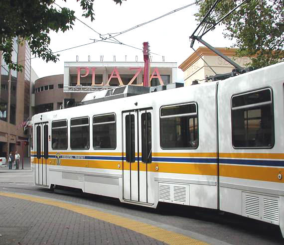
In this
view a train is turning south from the transit mall along K St. onto 7th St., in front of what was then called Downtown Plaza, a major shopping center.  Beyond that the tourist district of Old Sacramento beckons, with one of the country's most notable railroad museums nearby. 
Links to Individual Pages:
Prior to Opening Watt / I-80 Downtown Transit Mall
One Way Downtown Waiting for Street Traffic At Alkali Flat/La Valentina
Later in History North on 12th St. Watt/I-80 Terminal
North on K St. 16th St., Outbound Terminal at Meadowview
Before Departure Vehicles from CAF Power Poles and Overhead
12th & I Crossing I St. Stores Along K St.
Over the UP At Florin St. Rose of Lima Park
Near 16th St. 16th St., Inbound Toward Downtown
Turn at 12th and K Where Rails Once Ran Bumper at Folsom
Crossing Butterfield Crossing the UP Joining Up
Corner, 7th and K Single Track on H St. Finishing Touches, 7th St.
Trees Along O St. Terminal, Amtrak Abreast Restrictions
From Sacramento Valley Passengers Must Exit 8th and K Sts.
Out to Folsom Caution Signal At Sacramento Valley
Beyond J St. Turning onto K St. Three-Car Train, Butterfield
Sunrise Capitol Parkway Freight Below
Junction, from the West At Historic Folsom Yard Tracks Beyond
Overpass and Winter Sun Outbound on O St. State Capitol
Turning Toward Downtown Beyond 9th St. Roadwork Ahead
Gate Down, Train Crossing Junction, from the West Skyscrapers Beyond
Terminal, Amtrak Adjacent Crossing S St. Hard Rock Café