|
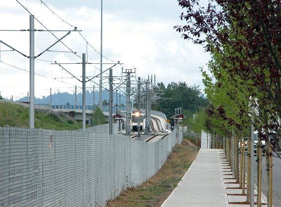
The train in this image is at the Delta
Park/Vanport station, and has reached the end of its running across the
Vanport Bridge. The next section of track will take it along
ground-level private right of way to Expo Center. As is the case with
much of the history of MAX, there has been much planting of trees near the
new route.
The Vanport name honors the former city called that, once situated to the
west of this location. Vanport was built in
response to the need for massive low-cost housing to support World War II industrial
production. Its elevation below that of the Columbia River doomed it
to a massively destructive flood when a dike failed in 1948. The
community,
population of over 18,000, mainly Black, was destroyed, less than a decade after it was
created.
The flood
seems to be little-remembered in the greater flow of American history.
I first learned of it by listening -- without any choice in the matter -- to the often twisted commentary of a very loud passenger
who was
taking his initial tour of the Yellow Line, shortly after its opening, with his
companion. In this case
he was mainly correct in his facts, as I later found out checking this and
that on the Web. |