|
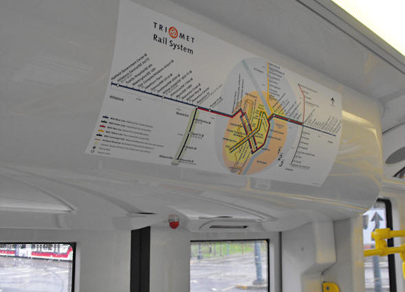
PORTLAND MAX LIGHT RAIL
Rail Map, 2009 |
|
|
|
Vehicles display a large map showing urban rail in the
Portland area, including the four MAX routes, the commuter line on the
Westside, and the Streetcar. This is the standard version such as it
was in late-summer, 2009, after Portland Mall and the Green Line began
service.
This image was close to the Rose Quarter Transit Center
station. A Yellow Line train can be seen at the lower left.
|
|
|
|
|