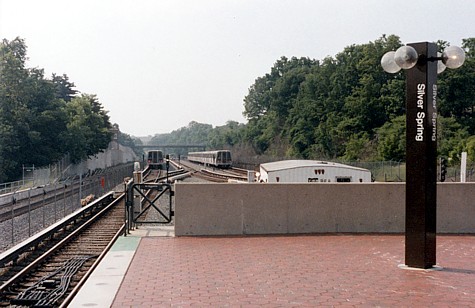
This photo
was taken when Silver Spring was the terminal on the more eastern Maryland
leg of the Red Line. That part of the line has since been extended three fairly distant
stations up to Glenmont.
MARC commuter rail and CSX freight use
parallel tracks seen here to the left. This is one of many locations
where Metrorail runs outdoors adjacent to traditional rail rights of
way.
The schematic Metro map that in various versions is
displayed in stations, on vehicles, and is
handed out to tourists and other passengers, has had a consistent
appearance for decades now. The Red Line shows as a crooked and
squiggling "V" heading out from DC to its two Maryland
terminals, Glenmont and Shady Grove.
If one looks at a geographically correct system map, there is an even more
severely pronounced
shape to the line -- sort of like a jagged, erratic test-tube to the north and northwest
of the heart of the District. |