|
LOS ANGELES METRO HEAVY RAIL
Metro Rail Map |
|
|
|
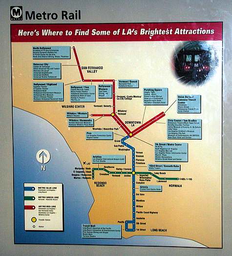
Most urban rail systems utilize diagrams to help
customers navigate their lines, and great geographic distortion is common.
This older Metro Rail map may take the prize for challenging
reality. It shows the downtown portion of the Red Line subway as
being grossly
expanded when compared with, for example, the Green Line light rail which
extends about twenty miles from Redondo Beach to Norwalk.
Much has changed since the time of this photo. What was once the
Red Line subway with two branches is now identified with different colors, Red and
Purple. The Gold Line light rail from East L.A.
out to Pasadena is now part of the rail scheme. And rail maps show
three "Transitway" bus routes. |
|
|
|
|